Introduction
On Friday 14 October 2022, significant flooding occurred within the urban catchment of the Maribyrnong River. In response, an independent review was established, and 15 recommendations were handed down to Melbourne Water. Melbourne Water is the entity responsible for managing all elements of the water cycle such as providing clean drinking water, treating sewerage, planning flood prevention monitoring and maintaining Melbourne’s rivers, creeks and catchments.
Two Melbourne Water projects that have come out of this are:
- Maribyrnong River Flood Model
- Maribyrnong River mitigation study
Council is supportive of Melbourne Water undertaking community engagement, and we encourage your participation.
November 2025 update - Phase 2 consultation
Melbourne Water is seeking feedback online until Sunday 7 December 2025.
Visit the Melbourne Water Let's Talk page to give feedback on:
- The Options Map – The options to reduce flood risk mapped across the catchment.
- Evaluation Criteria – The evaluation criteria will be used to examine the ‘long-list’ of flood mitigation options, helping refine them into a shortlist.
- Long-list Handbook – The 200 options that were considered for this project.
Project 1: Maribyrnong River Flood Model
The new Maribyrnong River Flood Model is a waterway flood model. It simulates the flow of water when a river breaks its banks, helping to predict flood patterns and their effects.
The maps produced by the updated Maribyrnong River Flood Model are available on Melbourne Water’s website.
Melbourne Water is working to translate the flood mapping into planning overlays and will advise when communities and stakeholders can review and make submissions on the proposed new controls.
Project 2: Maribyrnong River mitigation study
This study forms part of the work needed to identify, develop and implement flood mitigation options. These will help to reduce flood risk in the lower Maribyrnong River catchment, while also reflecting community values as much as possible.
These could include:
- traditional infrastructure such as levees, retarding basins and improved drainage
- innovative solutions such as wetlands and other nature-based solutions
- water management strategies and projects
- flood-resilient building and design features.
The study started in early 2025 and is expected to finish by mid-2026.
Phase 1 of this project is now complete.
The engagement summary from Phase 1 is available on Melbourne Water's website.
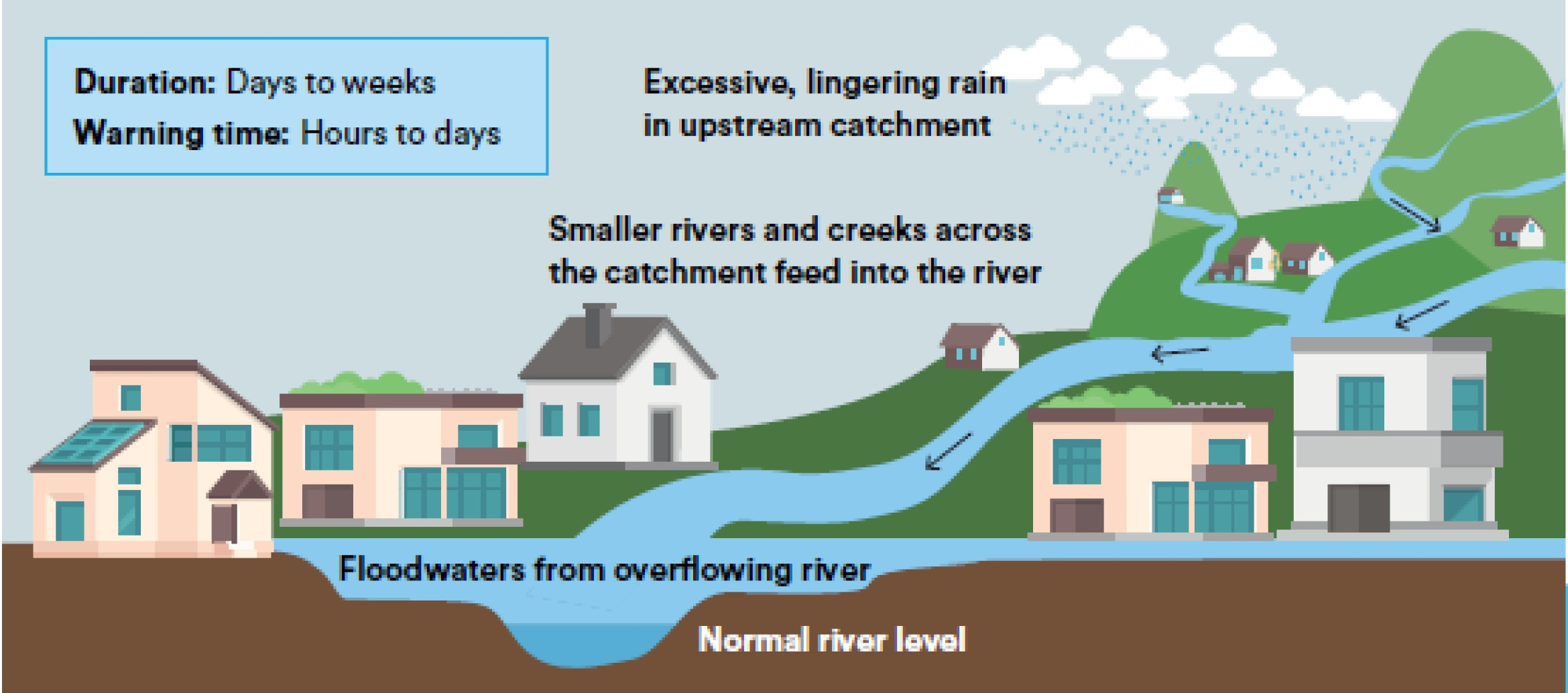
What is riverine flooding?
Riverine flooding happens when prolonged or intense rainfall in the upstream catchment causes rivers, creeks, or streams to rise and overflow their banks. The excess water then spreads across surrounding land, leading to flooding in areas near the river system.