Introduction
Our climate is changing. While overall rainfall may decrease, storms are becoming more intense when they do occur. Australian flood modelling guidelines now include climate change scenarios.
Across Victoria, councils are working with Melbourne Water to update flood models that predict where stormwater flooding might occur as part of Melbourne Water's Greater Melbourne Flood Information Program. These models project conditions to the year 2100, based on the expected impacts of climate change on rainfall patterns. For more information on flooding in Moonee Valley, please visit Melbourne Water’s Let’s Talk page.
Changes to roles and responsibilities
In October 2025, the Victorian Government announced changes to how flood-related planning controls are developed and approved. Melbourne Water is now responsible for preparing flood studies and modelling, and the Minister for Planning is responsible for progressing and approving flood-related planning scheme amendments through a streamlined, state-led process. Councils are no longer the proponent of flood-related planning scheme amendments and are not responsible for updating flood models, with Council’s role shifting to providing input into the process and supporting the community with information and local knowledge.
In Moonee Valley, a draft stormwater flood map was released for community consultation in 2022. Since then, new data has become available, and the model is being updated by Melbourne Water. Once approved, Melbourne Water will release revised maps for community feedback.
What is stormwater flooding?
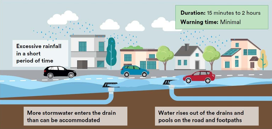
Stormwater flooding, also called flash flooding, occurs when heavy rainfall overwhelms the underground drainage system during a major storm.
Council’s underground drainage network is generally designed to manage regular storms, up to a 1 in 10-year event. This refers to a storm that has a 10% chance of occurring in any given year.
This project focuses on modelling 1 in 100-year floods. These are extreme events with a 1% chance of occurring in any given year. The modelling helps us understand and prepare for the risks they present.
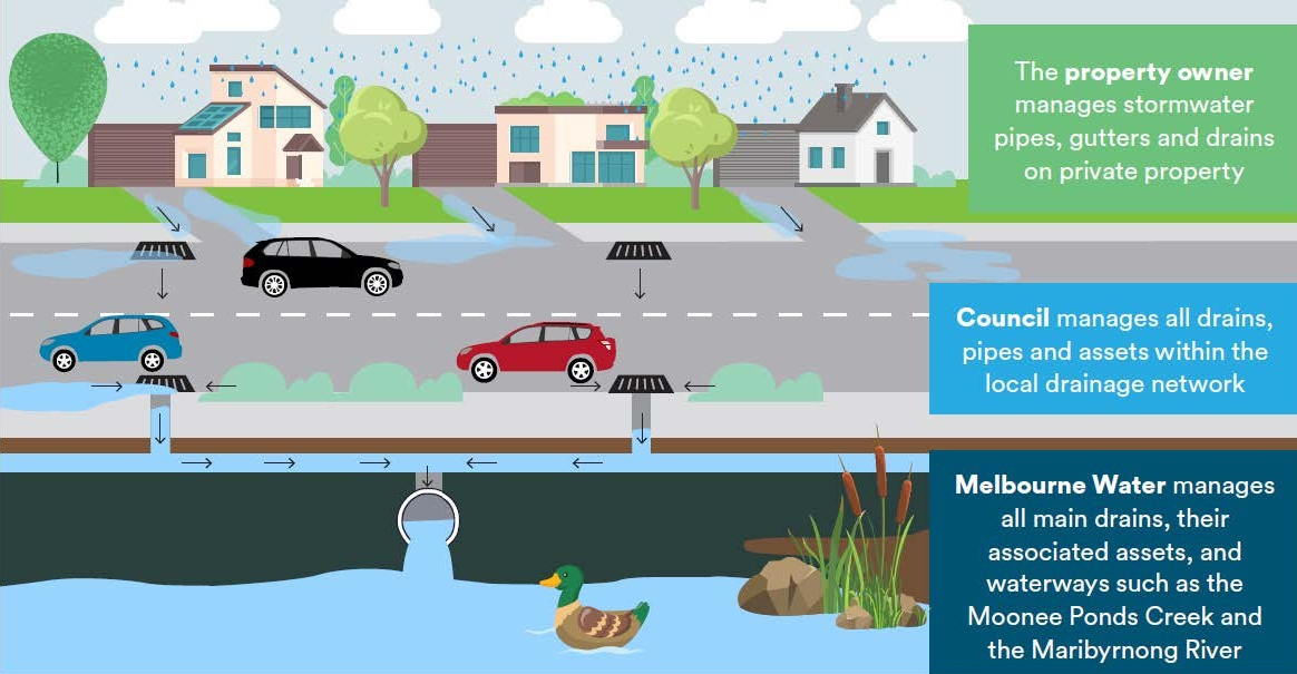
Who manages stormwater, drains and pipes?
Typically, the stormwater that collects on your property through gutters and drains, is then carried into the local drainage network, which connects to main drains before eventually flowing into creeks and rivers. Council manages the local drainage network in Moonee Valley, while Melbourne Water is in charge of main drains and waterways across Melbourne.